Welcome to our informative article on geothermal energy exploration. In a world striving for sustainable power generation, renewable energy sources such as geothermal energy hold great promise. Geothermal exploration plays a crucial role in identifying viable geothermal resources for harnessing clean and reliable power. By understanding the exploration methods and techniques used in the geothermal industry, we can gain insights into the advancements driving this field forward.
Geothermal energy is a renewable energy source that utilizes the heat stored beneath the Earth’s surface. Unlike other renewable sources such as solar or wind, geothermal energy provides a steady and continuous supply of power, making it highly reliable. Through exploration, we can uncover suitable locations for geothermal power plants, tapping into the Earth’s natural heat to generate electricity.
The exploration of geothermal resources involves a multidisciplinary approach, combining the expertise of geologists, geophysicists, geochemists, and engineers. These professionals employ various methods and techniques to identify regions with significant heat flow, such as rift zones, subduction zones, and mantle plumes. By understanding the geothermal characteristics of these regions, exploration aims to pinpoint suitable drilling targets and existing plumbing systems.
Advancements in exploration technologies have the potential to revolutionize the geothermal industry. By improving the accuracy and efficiency of exploration methods, we can reduce costs associated with geothermal energy production. Additionally, innovative exploration techniques enable us to de-risk drilling activities, increasing the success rates of geothermal power plant development.
Key Takeaways:
- Geothermal energy exploration is crucial for harnessing renewable energy sources and achieving sustainable power generation.
- Multidisciplinary approaches involving geology, geophysics, geochemistry, and engineering play a significant role in geothermal exploration.
- Exploration methods include drilling, geophysics techniques such as seismology, gravity, resistivity, magnetotellurics, and surface exploration techniques like mapping manifestations and temperature measurements.
- The National Renewable Energy Laboratory (NREL) contributes to geothermal exploration through its expertise in geological and conceptual modeling, geophysical and geochemical data analysis, play fairway analysis, and geospatial analysis.
- Advancements in exploration technologies and methodologies are instrumental in reducing exploration costs and increasing the success rates of geothermal power plant production.
Methods of Geothermal Exploration
Geothermal exploration involves various methods aimed at identifying suitable drilling targets and estimating geothermal reservoir temperatures. These methods include drilling, geophysics, and geotechnical surveys.
Drilling:
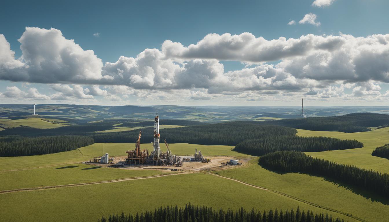
Drilling is the most accurate but costly exploration method. It provides valuable information on temperature gradients, thermal pockets, and other geothermal characteristics. By extracting core samples and conducting downhole measurements, drilling helps in understanding the subsurface geology and identifying potential geothermal reservoirs.
Geophysics:
Geophysics techniques such as seismology, gravity, resistivity, and magnetotellurics are crucial in geothermal exploration.
– Seismology: Seismic waves provide insights into subsurface qualities, helping to identify fault lines, fractures, and areas of high permeability. By analyzing the reflections and refractions of seismic waves, geoscientists can map the subsurface structures and identify potential geothermal reservoirs.
– Gravity: Gravity surveys measure the gravitational pull exerted by subsurface mass variations. This method helps in detecting changes in densities and identifying structural features such as faults and magma chambers, which are crucial in defining geothermal reservoirs.
– Resistivity: Resistivity surveys measure the electrical resistivity of subsurface materials. Different rock and fluid types exhibit varying resistivity values, allowing geoscientists to identify conductive materials such as geothermal reservoirs and areas of high fluid flow.
– Magnetotellurics: Magnetotelluric surveys measure the natural electromagnetic fields produced by the Earth and the variations caused by subsurface electrical conductivity. This technique helps in identifying resistivity anomalies associated with geothermal resources and determining the extent of fluid flow within the reservoir.
By combining these geophysical methods, geoscientists can identify subsurface anomalies, fault lines, and conductive materials, providing valuable insights into potential geothermal reservoirs.
| Exploration Method | Techniques | Key Information Obtained |
|---|---|---|
| Drilling | Core sampling, downhole measurements | Temperature gradients, thermal pockets, subsurface geology |
| Seismology | Seismic wave analysis | Fault lines, fractures, subsurface structures |
| Gravity | Gravity survey | Densities, structural features |
| Resistivity | Resistivity survey | Conductive materials, fluid flow |
| Magnetotellurics | Magnetotelluric survey | Resistivity anomalies, fluid flow within reservoir |
By utilizing these exploration methods, geothermal developers can make informed decisions during the exploration stage, reducing risks and increasing the success rates of geothermal power plant production.
Regional and Desktop Exploration
Regional exploration for geothermal energy begins with a thorough review of existing data and conducting meticulous reconnaissance studies. This initial step serves as a foundation for further exploration activities and helps identify potential geothermal resources.
Geological exploration plays a vital role in understanding the geological characteristics and identifying potential reservoirs. Through careful analysis of rock formations, structural features, and surface expressions, geologists can determine areas with a higher probability of hosting geothermal resources.
Geophysical exploration techniques complement geological studies by providing valuable insights into the subsurface. Methods such as gravity surveys, magnetotellurics, and seismic studies can detect variations in rock properties, identify fault systems, and map potential fluid pathways.
Once geological and geophysical exploration have been conducted, exploration drilling is carried out to test the results of surface studies. Drilling helps confirm the presence of a geothermal resource, validate the conceptual model, and determine reservoir characteristics such as temperature and flow rate.
During the exploration drilling phase, a preliminary resource estimate is obtained. This estimate provides an initial assessment of the size and power potential of the geothermal resource. It serves as a crucial indicator for further investment and development decisions.
By combining regional and desktop exploration techniques, geothermal energy developers can make informed decisions regarding the viability and potential of a geothermal resource. The integration of geological, geophysical, and drilling data allows for a more accurate assessment of the resource’s characteristics, ultimately contributing to the successful development of sustainable and renewable energy sources.
Surface Exploration Techniques
Surface exploration techniques play a crucial role in the comprehensive assessment of geothermal resources. These methods involve a combination of mapping manifestations, temperature and flow-rate mapping, using geothermometers, and conducting geological exploration.
Mapping of Manifestations
Mapping manifestations involves studying surface features such as hot springs, fumaroles, geysers, and altered rocks. These manifestations serve as visible indicators of potential geothermal activity and help identify areas with high heat flow.
Temperature and Flow-rate Mapping
Temperature and flow-rate mapping is a fundamental process in geothermal exploration. It involves measuring temperatures across a geothermal field to create a temperature gradient map. Flow-rate mapping helps identify areas with high fluid circulation, showcasing the potential for successful geothermal reservoirs.
Geothermometers
Geothermometers are instruments used to estimate the temperature of geothermal reservoirs. They rely on various chemical and physical properties of fluids and rocks to determine the reservoir temperature. Geothermometers provide important data for reservoir characterization and exploration targeting.
Geological Exploration
Geological exploration focuses on mapping lithology, structural geology, volcanology, and hydrogeology. Understanding the geological features of a geothermal area helps in identifying suitable drilling targets and potential fluid pathways. It provides valuable insights into the subsurface environment and aids in the development of conceptual models.

By integrating the results from surface exploration techniques into a preliminary conceptual model, geothermal developers can gain a better understanding of the size of the geothermal resource, reservoir temperature, expected fluid chemistry, and potential drilling targets. This information is crucial for the planning and development of geothermal power plants.
Geophysical Exploration Methods
Geothermal exploration utilizes a range of geophysical methods to gather crucial data and insights into subsurface conditions. These methods include resistivity, micro-seismicity, gravity, magnetics, and heat flow measurements.
Resistivity measurements play a vital role in identifying resistive cores within high-temperature geothermal fields. By measuring the electrical resistance of subsurface materials, resistivity surveys can help locate areas with suitable geothermal properties. These measurements are sensitive to variations in rock composition, fluid content, and temperature gradients, making them invaluable for geothermal exploration.
Micro-seismicity studies provide valuable information on seismic activity, including the presence of active faults, magma bodies, and fluid flow in fractures. By monitoring and analyzing micro-earthquakes, geoscientists can gain insights into the subsurface characteristics of potential geothermal reservoirs. This data helps identify areas with enhanced geothermal resource potential and can aid in determining safe drilling locations.
Gravity and magnetics mapping techniques play a crucial role in understanding subsurface structures and detecting thermal alterations in rocks. Gravity surveys measure the gravitational pull at different locations to identify variations in rock density caused by geothermal processes. Similarly, magnetics surveys measure natural variations in the Earth’s magnetic field, which can indicate the presence of geothermal activity. These geophysical methods allow for the identification of prospective areas for geothermal exploration.
Heat flow measurements provide insights into the temperature gradients in the subsurface. Understanding heat flow helps geoscientists estimate the geothermal resource potential of a specific area. By measuring the transfer of heat from the Earth’s interior, heat flow surveys aid in identifying regions with sufficient thermal energy for geothermal power generation.
The application of geophysical exploration methods, such as resistivity, micro-seismicity, gravity, magnetics, and heat flow measurements, enables geoscientists to gather critical information about the subsurface conditions and identify suitable locations for geothermal exploration.
Comparison of Geophysical Exploration Methods
| Exploration Method | Main Applications | Advantages | Limitations |
|---|---|---|---|
| Resistivity | Identifying resistive cores within high-temperature geothermal fields | Sensitive to geothermal properties, provides insights into rock composition and fluid content | Requires careful data interpretation, limited resolution in heterogeneous environments |
| Micro-seismicity | Detecting active faults, magma bodies, and fluid flow in fractures | Provides direct evidence of subsurface activity, aids in determining safe drilling locations | Requires extensive data analysis, limited spatial coverage |
| Gravity | Mapping subsurface structures, detecting density variations | Offers insights into rock density, helps identify areas of geothermal activity | Susceptible to noise interference, limited resolution in complex geological settings |
| Magnetics | Mapping subsurface structures, detecting thermal alterations in rocks | Indicates presence of geothermal activity, relatively inexpensive | Susceptible to magnetic interference, limited depth penetration |
| Heat Flow | Estimating subsurface temperature gradients, assessing geothermal resource potential | Direct measure of thermal energy distribution, aids in selecting suitable drilling locations | Requires specialized equipment, limited spatial coverage |
Geophysical exploration methods are essential tools in the geothermal industry, providing valuable insights into subsurface conditions and helping to guide drilling decisions. By harnessing the power of resistivity, micro-seismicity, gravity, magnetics, and heat flow measurements, geoscientists can unlock the full potential of geothermal resources and contribute to the development of sustainable energy solutions.
De-risking Drilling through Targeted Exploration
De-risking drilling is an important aspect of geothermal exploration. It involves reducing the uncertainties associated with exploratory drilling by employing targeted exploration techniques. Play fairway analysis, geospatial analysis, and geological and conceptual modeling are key methods used in this process.
Play Fairway Analysis
Play fairway analysis is a systematic approach used to assess the potential of geothermal resources within a specific area. It involves evaluating various geological, geophysical, and geochemical factors to identify favorable drilling targets. This analysis helps narrow down the search area and increase the chances of successful drilling.
Geospatial Analysis
Geospatial analysis plays a crucial role in geothermal exploration by collecting and analyzing geospatial datasets. By leveraging geographic information systems (GIS) and remote sensing technologies, geospatial analysis aids in the development of maps, models, and visualizations. These tools enable geoscientists to identify potential reservoirs, fault lines, and other critical features necessary for exploration targeting.
Geological and Conceptual Modeling
Geological and conceptual modeling techniques integrate various geoscientific data to create a comprehensive understanding of the geothermal resource. These models help visualize the subsurface features, identify the locations of potential reservoirs, and estimate the fluid flow characteristics. By simulating and testing different scenarios, geologists and engineers can improve the accuracy of drilling predictions and reduce the risks associated with exploration.

The use of play fairway analysis, geospatial analysis, and geological and conceptual modeling in targeted exploration is vital for successful geothermal development. These techniques help reduce the uncertainty associated with exploratory drilling, leading to more cost-effective and sustainable geothermal energy production.
NREL’s Role in Geothermal Exploration
The National Renewable Energy Laboratory (NREL) is at the forefront of advancing geothermal resource targeting and exploration techniques. With its expertise in geological and conceptual modeling, geophysical and geochemical data analysis, play fairway analysis, and geospatial analysis, NREL plays a key role in driving innovation and progress in the geothermal industry.
NREL’s capabilities extend across various types of geothermal resources and end uses, including hydrothermal, enhanced geothermal systems, sedimentary resources, and shallow subsurface characterization. By leveraging cutting-edge technologies and methodologies, NREL aims to optimize exploration strategies and mitigate risks associated with drilling.
One of NREL’s key contributions is in the field of geological and conceptual modeling. Through the integration of geoscientific data, NREL researchers create comprehensive models that provide a deeper understanding of geothermal resources. These models allow scientists to accurately assess reservoir characteristics and establish reliable exploration targets.
Additionally, NREL specializes in geophysical and geochemical data analysis. Through the interpretation of seismic, gravity, magnetotelluric, and geochemical data, NREL researchers can identify geothermal anomalies, fault systems, and thermal gradients. This analysis plays a crucial role in defining suitable drilling targets and assessing the overall potential of a geothermal resource.
NREL’s expertise extends to play fairway analysis, a technique that evaluates the geothermal potential within a specific area. By integrating various geoscientific datasets and using geospatial analysis, NREL researchers can identify areas with the highest likelihood of hosting geothermal resources. This allows for efficient resource allocation and optimization of exploration efforts.
Geospatial analysis is another area where NREL has made significant contributions. By collecting and analyzing geospatial data, NREL researchers create detailed maps, models, and visualizations that aid in exploration targeting. These tools provide valuable insights into subsurface conditions, helping researchers and industry professionals make informed decisions about drilling locations.
Overall, NREL plays a pivotal role in advancing geothermal exploration and resource targeting. Through its expertise in geological and conceptual modeling, geophysical and geochemical data analysis, play fairway analysis, and geospatial analysis, NREL is driving innovation and enabling the development of sustainable and reliable geothermal power generation.
Conclusion
Geothermal energy exploration plays a crucial role in harnessing renewable energy sources and achieving sustainable power generation. By utilizing a combination of geological, geophysical, and geochemical exploration techniques, viable geothermal resources can be identified, leading to the determination of optimal drilling targets. These advancements in exploration technologies and methodologies have not only helped reduce exploration costs but also increase the success rates of geothermal power plant production.
With further research and development, geothermal energy has the potential to significantly contribute to the transition towards a cleaner and greener energy future. By tapping into the Earth’s natural heat, geothermal energy offers a sustainable power source that can help reduce reliance on fossil fuels and lower greenhouse gas emissions. As technology continues to advance, it is becoming increasingly feasible to unlock the full potential of geothermal energy, making it an important player in the renewable energy landscape.
As the world faces pressing environmental challenges, the exploration of geothermal energy resources is an essential step towards achieving a more sustainable future. By harnessing the power of renewable energy sources such as geothermal energy, we can reduce our carbon footprint and mitigate the impacts of climate change. Investing in geothermal energy exploration and supporting advancements in the field is a crucial part of our collective effort to create a cleaner, more resilient planet for future generations.
FAQ
What is geothermal exploration?
Geothermal exploration involves the search for viable active geothermal regions with the goal of building geothermal power plants. It utilizes various disciplines such as geology, geophysics, geochemistry, and engineering.
What are the methods of geothermal exploration?
The methods of geothermal exploration include drilling, geophysics techniques such as seismology, gravity, and resistivity, as well as surface exploration techniques like mapping manifestations and measuring temperature and flow rates.
How is regional and desktop exploration conducted?
Regional and desktop exploration begins with the review of existing data and conducting reconnaissance studies. Geological and geophysical exploration are carried out to identify possible geothermal resources, assess their size, and determine drilling targets.
What are the surface exploration techniques used in geothermal exploration?
Surface exploration techniques involve mapping manifestations, measuring temperature and flow rates, and using geothermometers to estimate reservoir temperatures. Geological exploration focuses on mapping lithology, structural geology, volcanology, and hydrogeology.
What are the geophysical exploration methods used in geothermal exploration?
Geophysical exploration methods include resistivity, micro-seismicity, gravity, magnetics, and heat flow measurements. These methods help identify subsurface anomalies, active faults, and changes in densities and resistivity anomalies.
How does targeted exploration help in de-risking drilling?
Targeted exploration activities such as play fairway analysis, geospatial analysis, and geological and conceptual modeling help reduce the uncertainty associated with exploratory drilling, thus de-risking the process.
What is the role of NREL in geothermal exploration?
The National Renewable Energy Laboratory (NREL) plays a key role in improving geothermal resource targeting through expertise in geological and conceptual modeling, geophysical and geochemical data analysis, play fairway analysis, and geospatial analysis.
How does geothermal energy exploration contribute to renewable energy sources?
Geothermal energy exploration is a crucial aspect of harnessing renewable energy sources and achieving sustainable power generation. It helps identify viable geothermal resources and determine drilling targets, leading to the production of clean and sustainable energy.
Source Links
- https://www.nrel.gov/geothermal/exploration-targeting.html
- https://en.wikipedia.org/wiki/Geothermal_exploration
- https://www.esmap.org/sites/default/files/esmap-files/Flovenz Day 1 -WB-3-exploration-final.pdf
- Regulatory and Compliance: Pioneering the Future of Saudi Arabia’s Dedicated Cargo Airline - December 21, 2024
- Financial Strategies: Fueling the Growth of Saudi Arabia’s Dedicated Cargo Airline - December 20, 2024
- Operational Excellence: Ensuring Competitive Edge for Saudi Arabia’s Dedicated Cargo Airline - December 19, 2024


